The I-81 Interstate 81 Highway is
a major
automotive & trucking transportation
corridor and interstate highway that travels generally in a north/northeast-south/southwest
direction along the eastern inland coast of the USA.The i-81 somewhat
parallels the larger/longer i-95... and because the i-81 roughly parallels the
i-95, the i-81 has popular with the trucking industry because it by-passes the
larger & more congested i-95 cities.
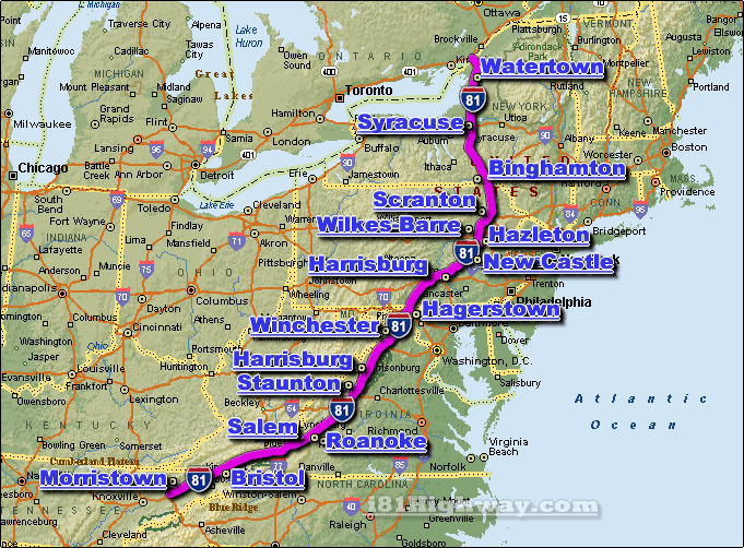
The i-81 travels thru 6 US states, those being;
Maryland, New York,
Pennsylvania,
Tennessee,
Virginia, and West Virginia.
At it's north-end, the i-81 starts/stops at the Canadian/US border just south
of the 401 Highway in Ontario Canada ... at it's south-end, the i-81
starts/stops approx. 34 miles northeast of Knoxville, where the i-81 meets the
i-40.
Some of the larger cities located along the i-81 corridor include;
Binghamton
NY, Bristol TN,
Hagerstown MD,
Harrisburg PA,
Harrisonburg VA,
Roanoke VA,